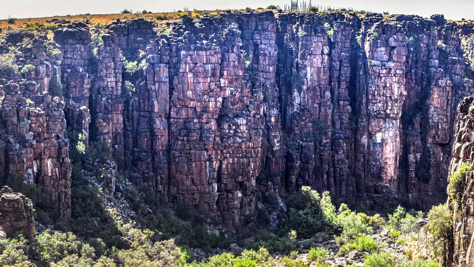
The Dolerite Cliffs
Towering columnar walls and canyon faces where cooling joints and erosion reveal the internal structure of the dolerite intrusion.
A landscape of dolerite cliffs, canyon floors, balancing tors and open plateau grasslands — formed during the breakup of Gondwana and later shaped by erosion, weathering, wildlife and memory.
This landing page introduces four geological zones within the canyon system, while keeping the full story of the landscape visible before the tour begins.
The canyon is only one expression of a much larger landscape. The same dolerite that forms the cliffs also appears as block fields, rock towers, koppies and weathered plateau surfaces across the surrounding plains.
Beneath this landscape lies one of the great geological stories of southern Africa. During the early Jurassic, as Gondwana began to break apart, magma rose into the Karoo Basin and spread sideways underground as thick dolerite sills. When the molten rock cooled it contracted and fractured into vertical joints and cross-joints. Over millions of years erosion exploited those weaknesses, carving the canyon and exposing the internal architecture of the intrusion.
Today the same process can be read at multiple scales: in the towering cliffs, on the rocky canyon floor, in the balancing tors scattered across the plateau, and in the almost level grassland plains where antelope once moved freely long before the reserve took its modern form.
Each zone can become its own krpano scene group or mini-tour. Together they explain the full structure of the canyon landscape from cliff edge to open plain.
Towering columnar walls and canyon faces where cooling joints and erosion reveal the internal structure of the dolerite intrusion.
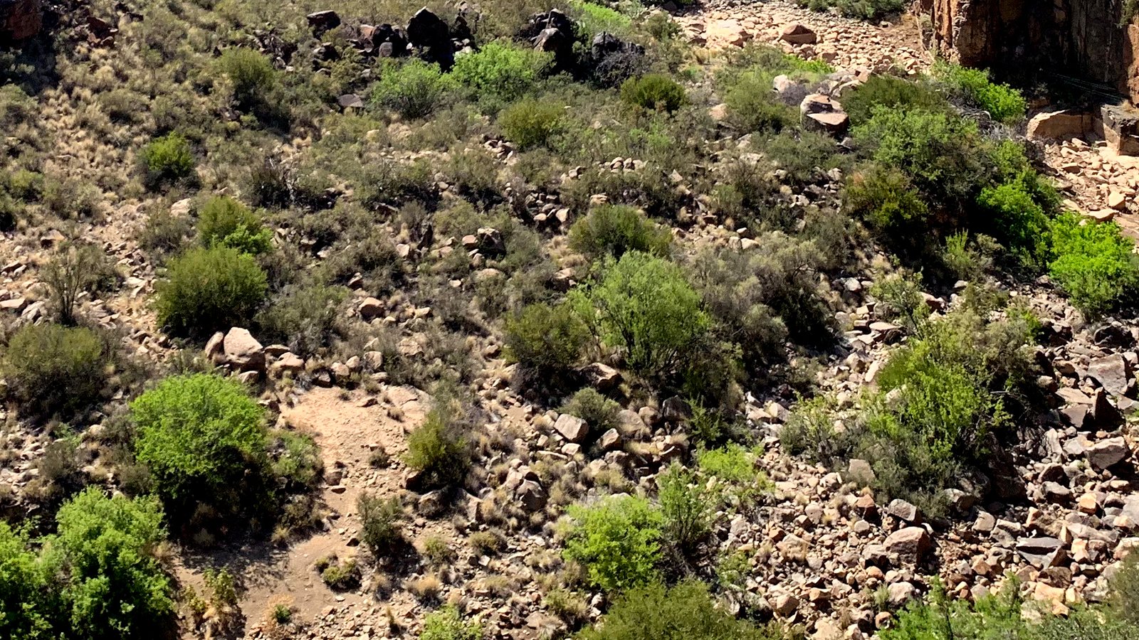
Where rockfall, seasonal water, alluvial debris and sheltered vegetation interact beneath the cliffs.
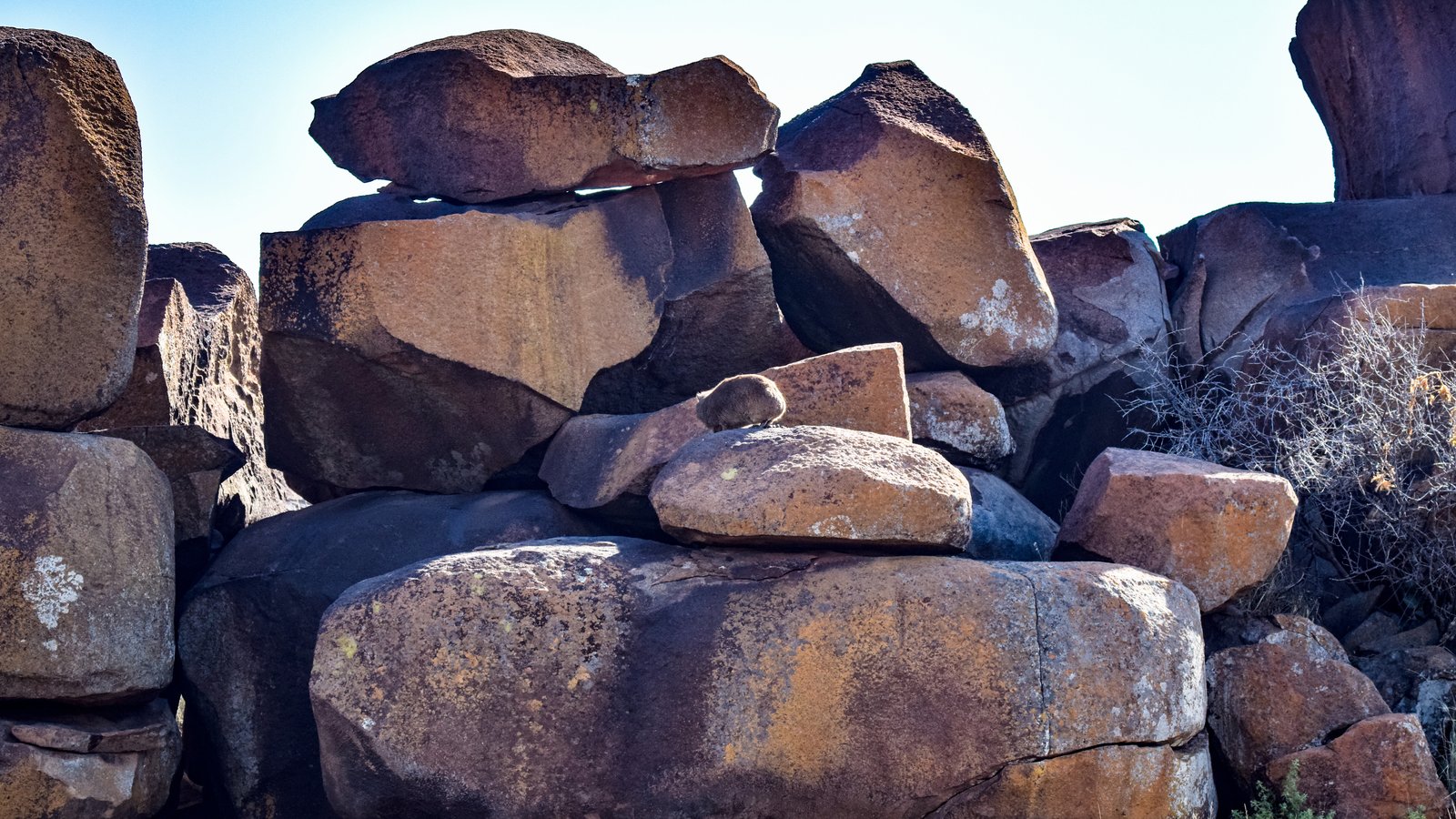
Balancing rock towers, split blocks and weathered outcrops showing how the dolerite breaks apart across the plateau surface.
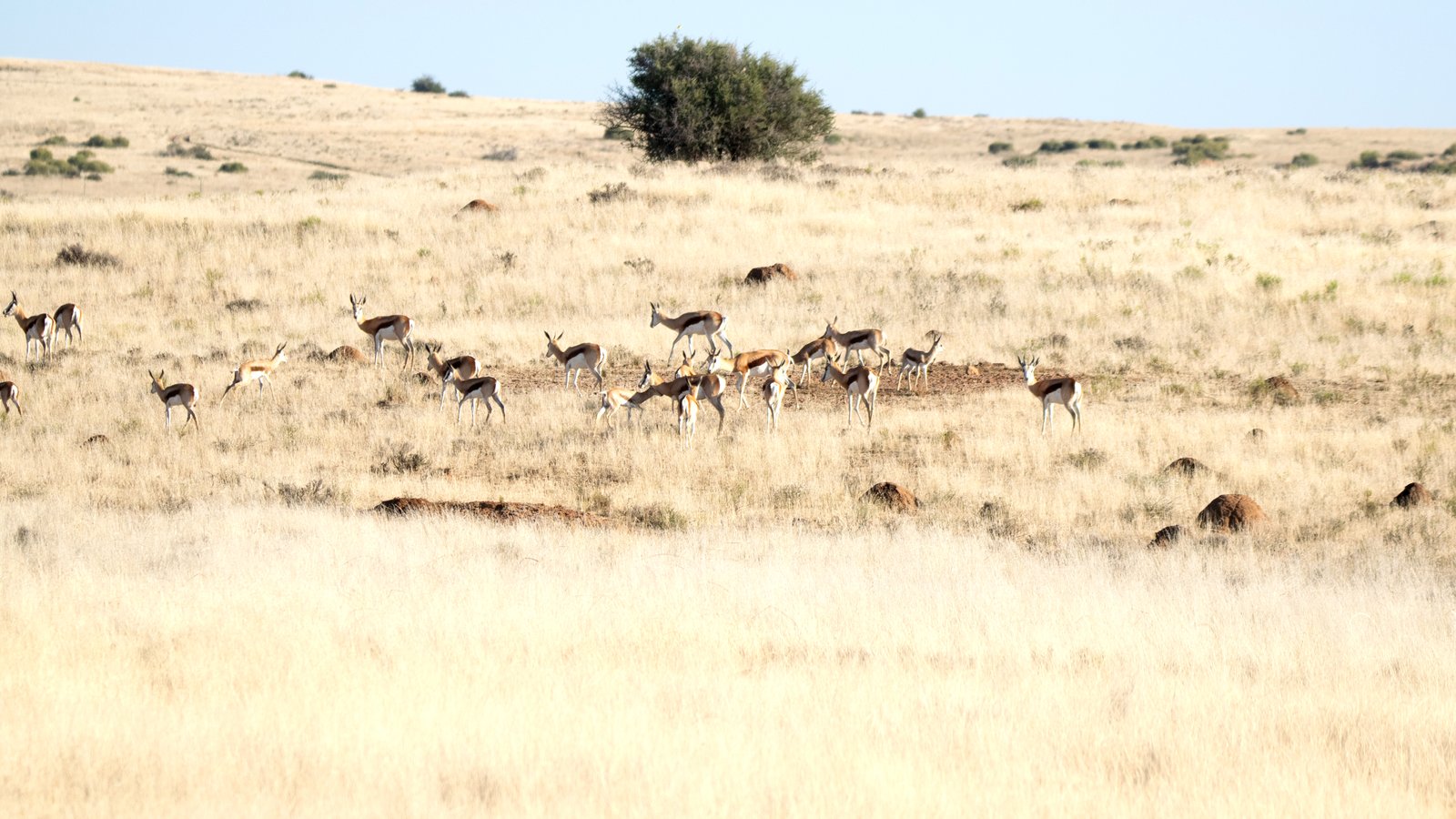
Vast open plains, koppies, scattered boulders and grassland ecosystems once dominated by springbok and now part of a wider reserve story.
The cliffs, tors and canyon floors of Tiger Canyon belong to a much older story: the breakup of Gondwana and the volcanic events that formed the Karoo Large Igneous Province.
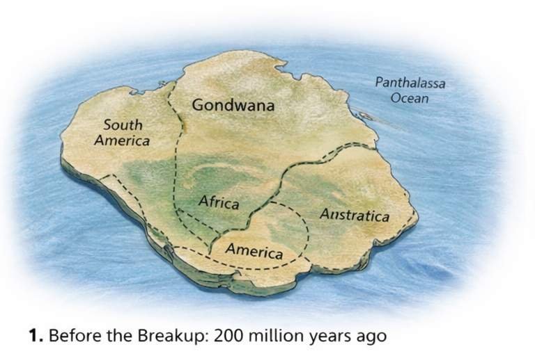
Gondwana was still intact, and southern Africa lay deep within the supercontinent above the thick sedimentary rocks of the Karoo Basin.
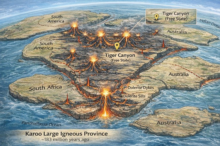
Tiger Canyon lies within the region shaped by the magmatic events that accompanied the breakup of Gondwana around 183 million years ago. The dolerite cliffs and canyon landforms seen today are part of that geological legacy, later exposed and sculpted by erosion.
Long before the reserve and tiger sanctuary existed, the plateau supported native grassland wildlife, especially springbok. Today the landscape carries both its older ecological identity and a newer conservation story, making it possible to interpret the area not only through geology but also through the changing relationship between landscape and animals.